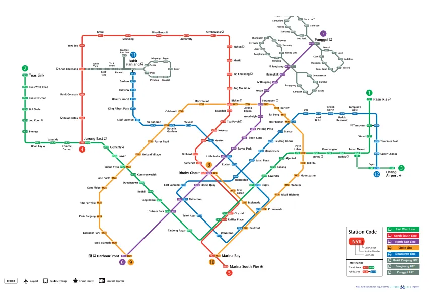
The MRT and LRT system map of Singapore provides a clear and efficient overview of the country’s world-class public transport network. Operated primarily by SMRT Corporation and SBS Transit, the Mass Rapid Transit (MRT) lines connect major districts such as the Central Business District, Changi Airport, and popular residential areas.
The Light Rail Transit (LRT) lines serve as feeder systems within neighborhoods like Bukit Panjang and Sengkang, making last-mile connectivity seamless. The map uses color-coded lines and clearly marked interchange stations, allowing commuters and tourists to navigate easily across the island. With its reliability, cleanliness, and extensive coverage, Singapore’s MRT and LRT system remains one of the most efficient urban rail networks in the world.